


EPIQ AND BRUTAL

View from Mt. Whitney
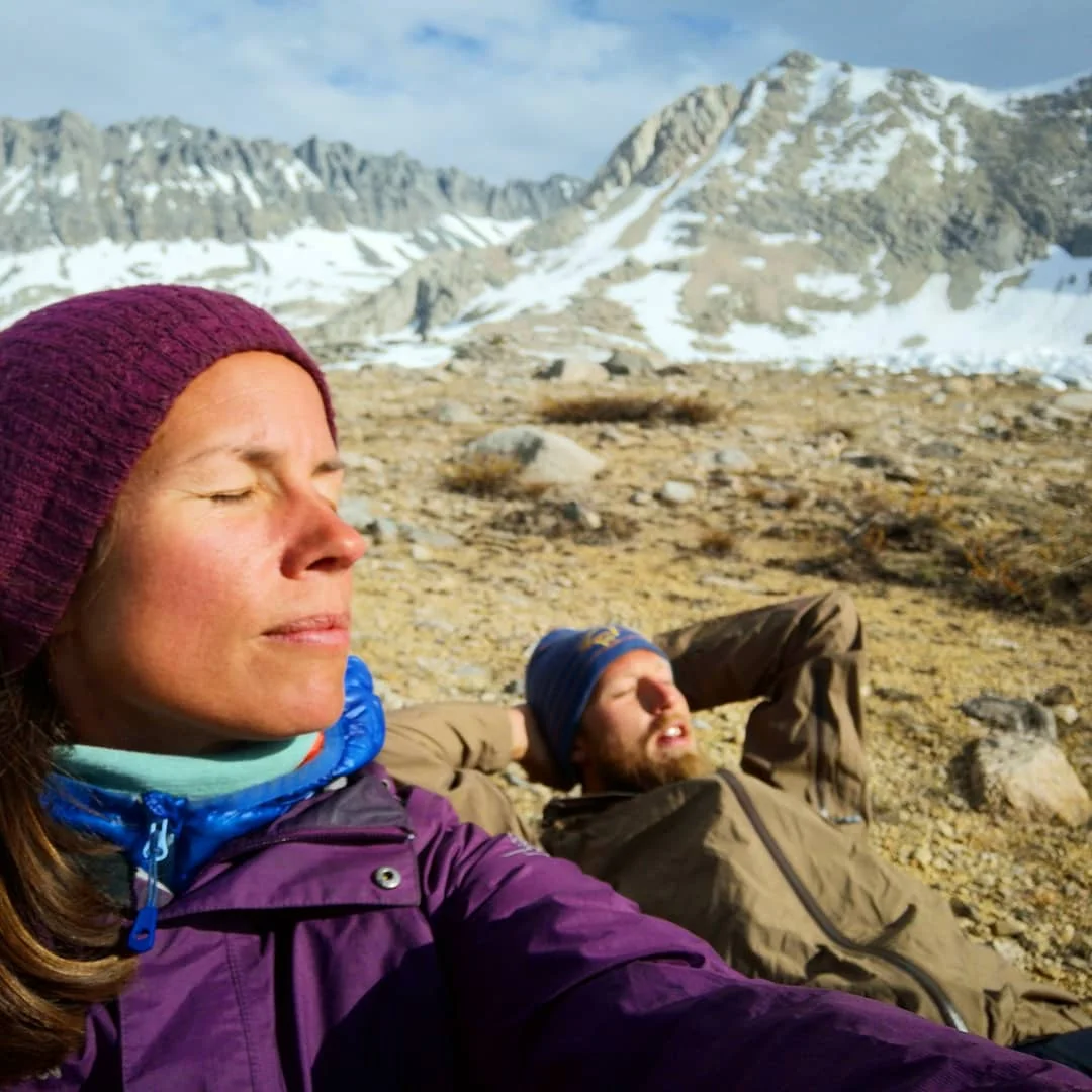
Here we are. Emerged from the wilderness after 15 days through the High Sierras. 7 times on top of the world; Mt. Whitney, Forrester, Glen, Pinchot, Mather, Muir, Selden and Silver pass. It has been long days, icy snow, slushy snow, endless snow fields, sun cups as deep as wells, sketchy traverses, steep climbs, steep descends, rockscrambling without trail, roaring rivers, icecold crossings, water everywhere, soggy swamps, no trail, wet shoes, sunburnt skin, cracked lips and sore lungs. But they who are not walking can not see the glorious beauty of the nature here, the endless horizon, the thousands of wildflowers, they cannot be surrounded by the giant mountains and conquer them, the breathtaking views from the top, the feeling of accomplishment and power, the feeling of being just a small piece of the universe under a thousand stars. To be in this true wilderness that opens your heart and widens your soul. The beautiful beast of the Sierras has chewed us up and spit us out again and it was just immensely worth it.

This is our little diary from the last two weeks. I hope you will enjoy the read and maybe a small seed of inspiration will grow inside you.
Section 2 - day 4 - 14 miles - 22,4 km
Woke up in our motelroom happy and rested. Fixed the post office and ate a great breakfast burrito in a café before we packed up and stuck our thumbs up hoping to get a hitch up to Horseshoe Meadow. Fortunately for us we got a ride with the sister of a hiker we met out on trail all the way up. People are so kind. Hallelujah.
We decided to take the trail up to Cottonwood pass and rejoin the PCT there and hike to Rock Creek. We hiked up and up and met the snow and a bunch of other hikers along the trail. We got excellent views of the mountains up at 11500 ft! So high! The rest of the day we hiked down through trees and sandy trail and finally found a great campspot down by rock Creek. We love our new tent! So great to have a rain fly! Two deer joined us as dinner company grazing in the meadow. Just perfect.

Day 5 - 11 miles - 17,6 km
Our goal today was to get to Crabtree Meadow where we would start our climb of Mount Whitney tomorrow. We packed up camp and had our first river crossing over Rock creek. We found a good log, crossed and bushwacked to the PCT 0.5 miles further up. Started out with a steep climb and I get really out of breath at this elevation! The rest was a really easy hike and we arrived at Crabtree at noon. Had lunch and decided to head up trail to find us some camping there. Since Guitar Lake is off limits to pct hikers we decided to take a chance and go up even higher towards the switchbacks that leads to the summit. It was a beautiful hike up the valley. I can't believe we are this high! 3550 m! We found the most beautiful amazing spot all to itself a little bit higher than Guitar lake and decided to camp there. And here I sit writing this! Sun, love, lakes, marmots, t-shirt and the most glorious view. Omg I am so glad to be here!!
Day 6 - conquering Mount Whitney!
+ 8 miles to Tydall creek

We got up at 01:30 to get ready for our summiting of Whitney. A few headlamps passed our tent and we quickly got into our clothes and headed out in the dark. Headlamps on and ready for the big climb. The trail had mostly disappeared the first part and we moved slowly upwards through the snow and boulders navigating on Gaia. Having no trail was very exhausting, but fortunately we found it just before the steep switchbacks started. We climbed and climbed, steep and rocky. The elevation making our breath heavy and short. But our hiker legs has really come back and we slowly and steadily got higher and higher. A few sketchy traverses with snow where we used our microspikes and ice axes. Don't look down! A steep snow field met us almost at the top and we hiked up on pure will. Legs and breath tired of the elevation. But finally we got to the top just in time for the sunrise. And how breathtakingly beautiful it was. We huddled close together in our sleeping bags and saw the sun color the horizon red. Made coffee and smiled. 4468m! The highest we have ever been! And the views were amazing!

After a short while we hiked back down, packed up our camp, hiked further down to Crabtree Meadows were we had lunch and rest. Today's camp goal is to Wallace creek as we are getting closer to Forrester pass, the highest point of the PCT.
Day 7 - Forrester pass - 10 miles - 16 km
We had a long day yesterday after Whitney hiking towards Forrester pass. Came into camp at 7pm after fording Tydal creek which was roaring! Had to walk the river upstream for a while before we found a crossing where the river divided into three. It was still such a strong flow! We got supercold after crossing in the ice cold water and could not huddle up in our tent fast enough.

We woke up when the sun came over the mountains, had breakfast and packed up. Just 5 miles to the top of Forrester pass which is the highest point on the PCT; 4000 m, 14000 ft.
It was a beautiful hike in and up towards the pass. Lots of snow fields but it was easy to cross. Our microspikes were just great! We took our time and slowly got ready for the steep climb up in the snow. I was really surprised how easy it felt going up and suddenly we were on the top. Amazing views in all directions. We're really doing great! Hiking down the pass on the other side was snow, snow, snow and we lost the trail several times. Quite exhausting. We glaceded down a steep slope; so much fun! The rest of the hike down in the valley was melting snow and water everywhere. Climbing over heaps of snow and over slushy snowfields. Not so much fun. Found a great place to camp by Bubbs creek and are having a lazy afternoon. Washing ourselves and our clothes. Tomorrow we head up to Kearsarge pass where we will meet our dear friend Gemma! It will be so GREAT to see her again!

Day 8 - 5 miles - 8 km - waiting for Gemma day
Today we slept in and it felt great. I think we slept 13 hours. Lazy breakfast, packed up and hiked the 5 miles up to the Kearsarge trail junction were we waited all day for a Gemma. At 6 we walked to the closest tentsite and set up camp. Then suddenly Gem came bushwacking through the forest and we were so happy to see her! Had dinner and talked and she is all the same <3

Towards Muir pass
Day 9 - Glen pass - 13 miles - 20,8 km
Got up at 6 and got ready. So many hikers camping and heading up towards Glen pass! I think we counted 40... So leapfrog it is... Gemma's first day and right on climbing steep uphill. When we got closer to the pass we had to cross some big snow fields, but the tracks were really good and we were fine without our microspikes. Gemma had trouble getting used to the altitude so it was took a while to get to the top. Such a beautiful view from the top! That's the prize for climbing; views! Quite steep and sketchy descent from the pass on a huge snowfield switchbacking pretty much right down.

Descending Glen pass
The rest of the descent went fine and we came down to the beautiful blue Rae lakes. The trail was easy and scenic as we hiked along the differed lakes. Then we went down down down all the way to the valley and Wood's creek which fortunately had a suspension bridge we could cross on. Gemma had been really struggling the whole day and after a small but sad family meeting she decided to exit the trail through paradise Valley. It is long and hard days and we really have to push hard! She felt she couldn't make it and it was a smart decision to make. The Sierras are a brutal beast and when you go in you have to push through. We were extremely sad to see her go after just one day!! There is no shame in turning around. She will conquer the mountains another time! She very kindly gave us some of her food which we were extremely grateful for. We were running a little low... And now we can go all the way to Mammoth. Thank you Gem! We love you and miss you already! Tonight we had a feast with gummy bears and Nutella :))
Day 10 - Pinchot pass - 13 miles- 20,8 km

Marmot friend
We started out thinking we would have an easy day. Bounce over Pinchot pass and maybe even make it over Mather. But hey, reality check; snow everywhere. And really long long hike up to Pinchot on huge snow fields. After what felt like forever we summited the pass and quite quickly started our descend down on the other side. Traversing and rockscrambeling down the side. No trail to be found after the first traverse, just navigating down through snow and rocks, trees and melting water. Everywhere water. With soaked shoes we slowly made our way down the valley hoping to find the trail somewhere. Far down we finally found it, crossed a big creek and continued down trail towards the treacherous Kings River. Crossing was not an option, it was raging! So after a very much needed lunch break we hiked up a few miles along the river and crossed it where it diverted into many small creeks. Relief.

Then we were up in the snow again up towards Mather Pass. Dark clouds gathering over the mountains making us quite nervous. Halfmile said no more campspots closer to the pass, but we figured we would find something. But what if a bad thunderstorm would roll in? We would be extremely exposed. We still pushed on. So so hard. The snow was slushy and we spent forever crossing the snow fields. Maximum concentration on every step not to fall into the huge sun cups. But finally, at the base of the pass we saw tents. A big plateau free from snow. Such a relief!! And the clouds had disappeared. Phew. We got out of our wet shoes, pitched the tent, warm clothes and finally dinner. Highlight of the day. This must be our highest campspot until now; 11435 ft; 3812 m. Surrounded by the giants we will sleep a little cold, but tired and happy.

Our highest camp spot below Mather pass

Day 11 - Mather Pass - 20 miles - 32 km
Last night was extremely cold, we tossed and turned in the tent trying to get warm. The tent was completely frozen when we got up and ready to summit Mather. Some people were already up in the rocks and it looked fairly easy. Steep but short. We climbed straight up a snow wall and got into the rocks higher up. There we had a long and quite sketchy climbing traverse before we hit the snow and traversed over to the top. Go the honeymooners! We started the descent immediately and to our surprise it was quite easy to follow the snow trail down in comparison to the other days. And the valley was dry!! We couldn't believe our eyes. Hiking on dry trail? No snow? Amazing. And the valley was amazing all the way.

We followed two big rivers; first raging Palisade creek and then The middle fork of the king's River. Both triple in size because of the melting. So much power! Easy hiking through wildflowers and trees. Beautiful and warm. We really enjoyed it after being quite high and cold. Now we are camped high (again) trying to get a good start on Muir pass tomorrow. Quite exhausted and praying for a warmer night's sleep!

On top of Mather pass

Wilderness
Day 12 - Muir Pass - 17,4 miles - 27,8 km
We woke up quite rested. Not so cold fortunately. Headed up towards the epiq Muir pass; our last high pass before going lower tomorrow. The trail was huge endless snow fields up, up, up. And the valley was just completely stunning. Huge mountainsides covered in snow surrounding us. The sun. Frozen lakes. No one in sight. That is wilderness. That kind of breathtaking wilderness that opens our hearts and widens our souls. On top of the pass; the epiq Muir stone hut. It felt very special to be there. Like we have followed the tracks of history. The view! I will save it in my heart always.

Descending Muir pass

View from Muir

The epiq Muir stone hut on Muir pass
Descending for hours in the snow. 5 miles (8km) of slushy snowcovered valley.

Sun cups….
So so tiring. Lost the trail and found the trail. Over and over. Wet feet. River crossings. Swampy fields. It was just exhausting. After what felt forever we were finally out of the snow and found a great lunch spot by Evolution lake. Drying wet shoes, socks and sweaty t-shirts. Icecold swim in the lake. Bliss.

The best ❤️

The rest of the day we hiked down down down following Evolution creek through forest and swarms of mosquitoes. Not a welcome sight. The river was huge, tons and tons of water forcing it's way through the landscape. We managed to cross where the river was broad and calm, but still deep and swift. Wading through overflown meadows with mud to our ancles and attacked by mosquitoes at the same time was a gnarly experience. Yuk. At the bottom of the valley we found a good campspot by a river and no mosquitoes! Looking forward to a warm night's sleep before our last pass; Selden tomorrow.

Great camp spot by San Joaquin river

Happiest Nutella dude - love you!
Day 14 - Selden pass - 18,4 miles - 29,4 km
Chill morning hike along the river. Rumors were out about the hiker boxes at Muir trail ranch so we decided to take the small detour to see what we could find. Such a cute place! Small wooden houses in the middle of the forest with horses and greeting dogs.

Cutie at Muir trail ranch
The boxes were great! We found toothpaste, suntan lotion, ramen, chocolate, Gatorade powder, mashed potatoes, hot chocolate, protein powder, nuts and protein bars. Such a great score! And saved ourselves some money at the same time. Never wrong. Our packs heavy again! Phew. Just when they were getting light and comfortable...

Pinecone!

The rest of the day was uphill towards Selden pass. Snow and water and steep climbing. It felt like we never would reach the top. But hey! We always do. Had lunch on the top and a really exhausting descent through water and slushy snow. Then we met all our mosquitoe friends and crossed two huge rivers. Bear creek had a great log so dry crossing there which was great. The other we crossed in the swift water. Always a good feeling to reach the other side!
Quite tired we found a sunny spot by Bear creek, put up our clothes line to dry our things, had an excellent ramen dinner and now we are collapsed in our tent, protected from the mosquitoes. Tomorrow we will have a long day, hoping to reach Mammoth and TOWN in two days :)

View from Silver pass
Day 15 - Silver pass - 18 miles - 28,8 km
Woke up after a restless night of sleep and hoped for an easy day. Well the trail had other plans.. We had an idea that it would be quite straight forward towards Mammoth and ALL OF THE THINGS we would get in town (can't wait!) but it turned out to be a hidden pass just today. Well hey, not gonna not want to walk a few thousand feet down and then straight up again! (repeat Washington) yikes. We really went down; all the way and the climb up was 5 hours and really mean. First beautiful with a thousand wildflowers in all different colors, but after just loooong and steep with water and snow.

We reached the top (amazing!) and got to glazede down the other side which was fun! The descent in robotmode; going down, loosing trail, finding trail, crossing river, one two three times, balancing between water her and there and heaps of snow, then dry trail, mosquitoes and then uphill again and finally ; camp; FOOD! yes! We really look forward to getting into town tomorrow. We need rest, food, shower (!!), laundry and contact with the world. And then I will publish this :) night night zzzzz


Down from Silver pass
Day 16 - Duck lake and TOWN - 14 miles - 22,4 km
Cold night, packed up and ready to go. Got some hints about a shorter hike into Mammoth on the Duck lake trail and further to Mary Lake / Coldwater campground. It was quite a hike;lots of snow and up and down, but when we finally got there we were fortunate to get a hitch immediately which was great. Finally! We were quite ready.
In Mammoth we quite quickly got the idea that the place was expensive and spread out. We couldn't really get a grip on the place. We had a great lunch and decided to hitch our way to Bishop. A town a few miles back that is a bit more hiker friendly. We stuck our magic thumbs out and got a hitch first half way, then we got lucky enough to get a new hitch immediately with a cool snowboard dude that decided to take us all the way. Just because we were so nice :)
Now we are in a super nice small motel, we have done laundry and showered our ridiculously dirty selves, and are now straight out on our bed clean drinking the best stout and eating pizza. Can life get any better??? Yes, tomorrow we have a zero and can sleep in and drink coffee and go to the bakery, eat one more burger and just do nothing. Ahhhh... And just know that we have deserved it. Thank you life <3

I love this trail

